Blog #15 March 9-12
Wednesday was our day to leave. David had just returned from a trip to the famous car show at Amelia Island on Monday, and Tuesday was his catch-up day – which turned into Wednesday. Luckily, it gave me more time to pack. Did we still forget some minor things? Of course, but they were truly unimportant, like a water filter that can purify muddy water in Africa. It might have helped make campground water in Oklahoma more palatable, but our regular filter that we attach to the trailer every time we camp works just fine.
Many people ask me where we are planning to stop over. While it might be inconceivable to some, we don’t always worry about that. We have a starting point and often we have to be at our ending point by a certain date. We try to build in some cushion for unforeseen circumstances – and we’ve had those. It could be extreme, like the time our trailer window broke and blew out on a lonely, windy road in New Mexico. On the other hand, flexibility allows us to have “fun” surprises, like when we see a road side attraction that we HAD to go to (who would pass up going to the 40 foot high Jolly Green Giant statue?). When you’re RVing, you have to keep a flexible mindset. It’s not like we have to be at the airport at a certain time and ensure that we have a rental car and hotel at the other end.
That said, I did make plans for this trip. I had a spreadsheet with our stops, drive times, mileage, and even included campgrounds that could handle our rig (some places don’t take our length trailer and truck combo). I wanted to be sure we wouldn’t have super long days of driving so I mapped out a trip that maxed out our daily drives to 6 or 6 ½ hours. All the trip planning went out the window since we left at 4pm instead of any time before 2pm. The planning was premised driving to Nashville for 4.5 hours on the first day. Instead, we drove over the mountains, past Knoxville and stopped at a Cracker Barrel somewhere before Nashville.
The next morning, we drove to the DNA Property in Germantown, TN about a 5-hour drive. The shopping center is in a fairly high-end area within Memphis. And it is right across the street from two stores that call to me: The Container Store and Trader Joe’s. At the former, I got a few more things to organize the Airstream. And I never have a problem finding items I need at Trader Joe’s.
There is lots going on at the DNA Shopping Center. One large new tenant is opening, another has some issues with a construction project. David had to meet with about 20 people in 2 hours to move things forward. He got done what he needed to and we drove another couple of hours to Arkansas.
We didn’t make it to Little Rock as originally planned and instead found an RV park off I-40 in Brinkley, AR. I’ll include some photos of the town below. These are just a few of the houses on the main street.


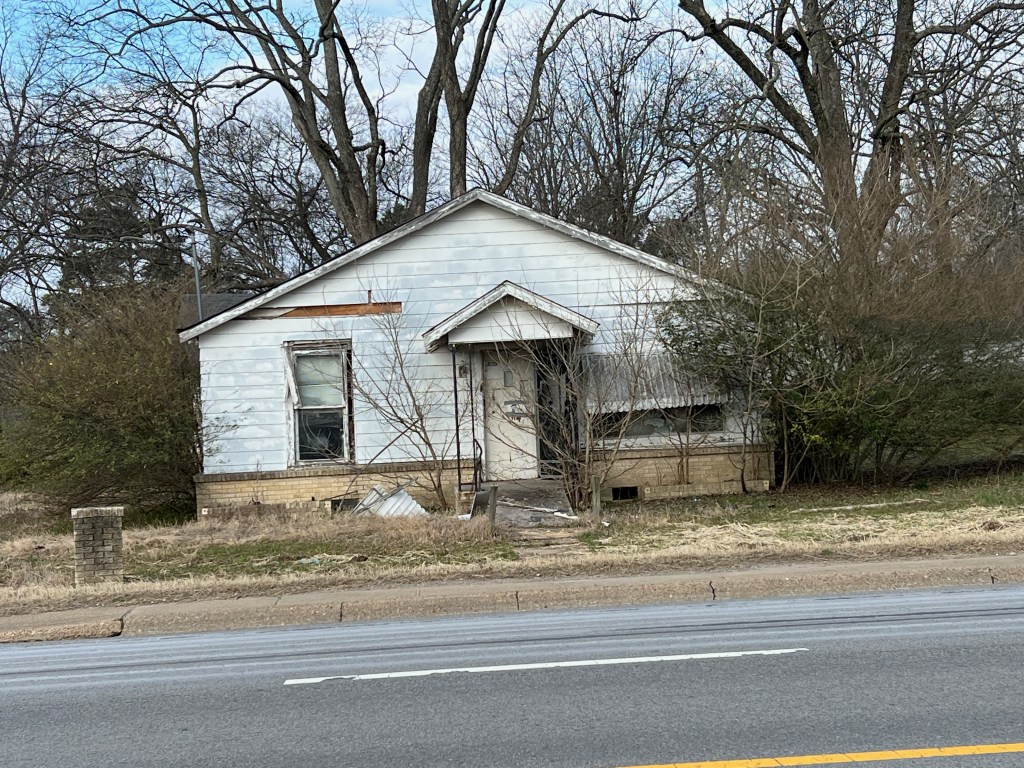
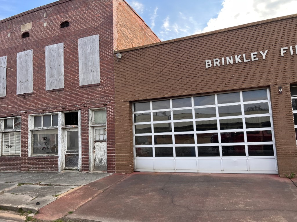

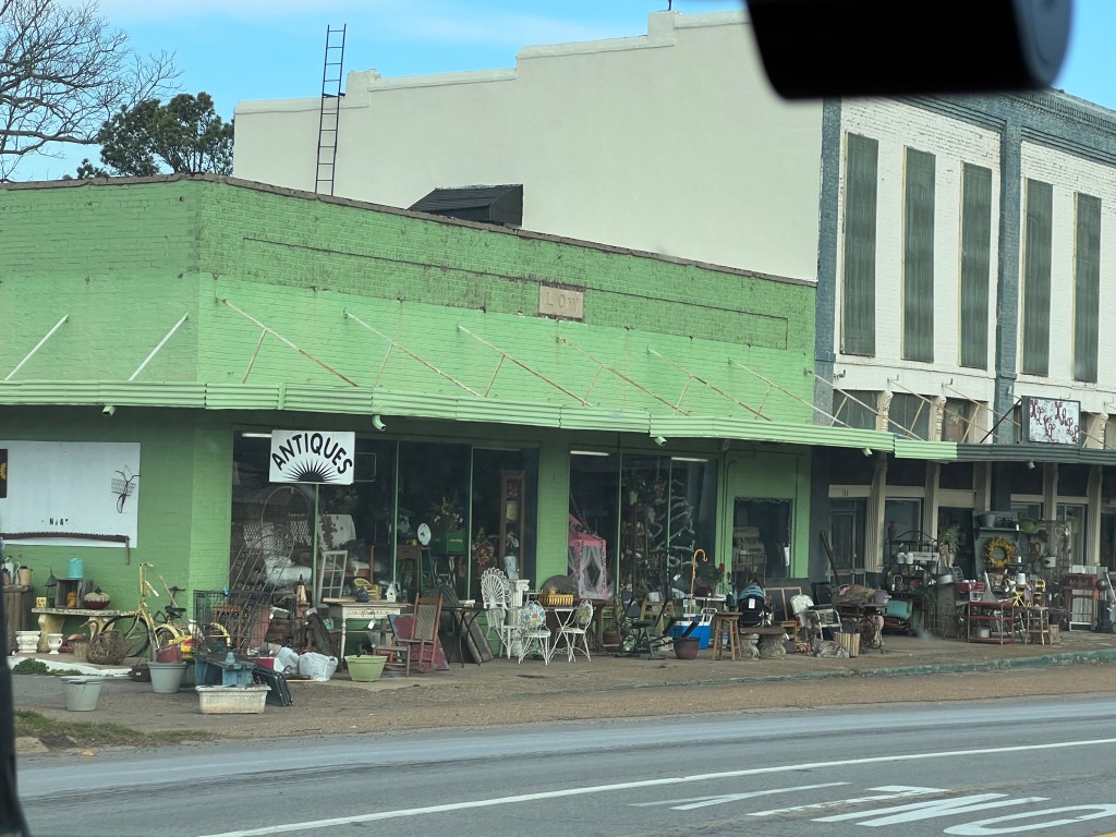

Driving across the country reminds us not only of how lucky we are, but how most of America lives. may complain about rising gas prices and inflation, but honestly we’re not going to be drastically affected. People living in this part of Arkansas may have to make a choice between driving to work and eating. To hear our political leaders exhort people to buy electric cars when people in Brinkley, AR can barely afford to fix their car breaks my heart. And the disconnect makes me want to vomit.
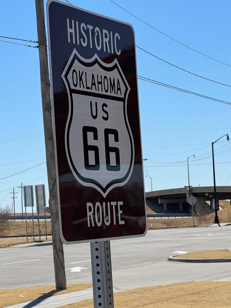
Interstate 40 is our friend. Much of it also contains the old Route 66 that we all got our kicks on. We drove the next day through Little Rock, AR and Oklahoma City, OK stopping in each for a Trader Joe’s run. Anyone who knows me, knows I’m a fan, but I’m also in it for the bags. Every state that has a Trader Joe’s has its own bag and some states have special bags for specific cities. I’m trying to collect at least one from each state, but I’ve been having some trouble adding to my pile. When I got to Little Rock, the cashier told me that although they’ve been open for 18 months, they still don’t have a bag designed for them. In 2017 I had the same problem when we visited Boise, so I could see this as an issue. I think I may have one from a previous trip to Oklahoma, but when we had a chance to stop in to Oklahoma City, the detour was inevitable.

I picked up a couple of things but you may wonder what more could I possibly need? Sliced calamata olives of course! You can’t travel around the country without those. Again the cashier had to apologize for not having a bag. It turns out that their previous bags were recalled, not for a defect like a handle that would break, but because there was a typo. The cashier said they have enough problems with the education system in Oklahoma without adding spelling mistakes on the TJ’s bag. So, I struck out two for two. Just wait until I get to New Mexico. If I have no luck again, I’m writing to corporate.


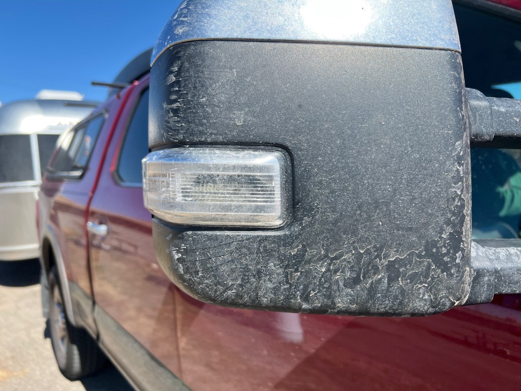
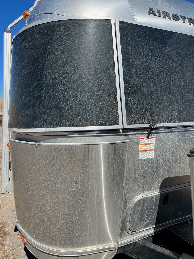
We stopped outside of Oklahoma City in a KOA called Reno West. Not sure it has anything to do with the other Reno, but it did have a Cherokee Trading Post and a pen with two Bison, the state animal. BTW, our rig is filthy after driving through AR where they salted the roads for the upcoming flurries.
Oklahoma was the 46th state to enter the union, and mostly it was set aside for Indian Lands, but only after we negotiated and then broke treaties with at least five tribes. As you drive through Oklahoma you see the names: Chickasaw, Cherokee, Creek, Seminole and Choctaw. Maybe I’m the only one who didn’t realize these were all considered the “Five Civilized Tribes” and were moved from the Southeast. I’m including an excerpt from Wikipedia to let you know how they got there. Obviously, the story is much longer, gorier and disheartening, but at least it will give you some brief knowledge of how Oklahoma became the Indian Territory. If you’ve read Killers of the Flower Moon, you know a little of how the Osage Indians became rich from the horrible land that was given them by the government and how unscrupulous people continued to take advantage and even murder them in the early 1900s.
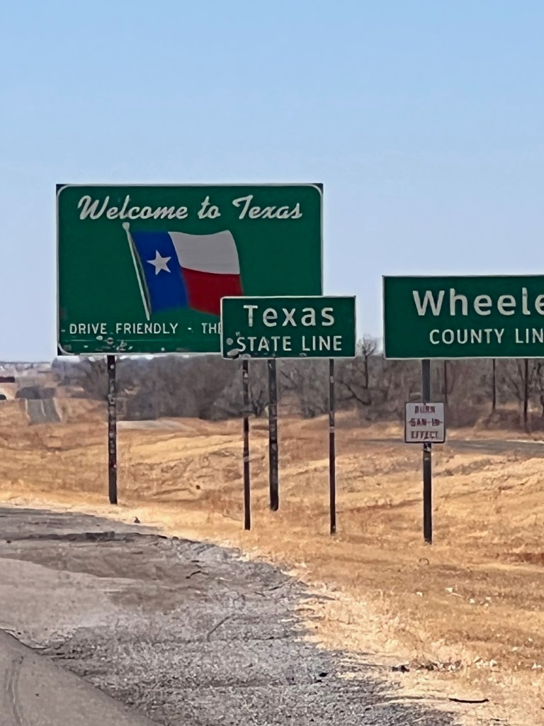
That said, Oklahoma is beautiful country. Arkasas is full of waterways and while Oklahoma has some that, the rolling hills are just beautiful. I could feel “the wind that comes whipping down the plain” lyrics while the trailer was lightly buffeted during the drive. Oklahoma flattens out going west and the sky gets bigger and bigger. The trees don’t grow tall, maybe 15 feet, and they gradually seem to disappear. Then you enter Texas, the part of the Panhandle that I-40 crosses, and everything is just like the bottom of the ocean. Flat flat flat. Cattle farms were more Oklahoma and this part of Texas is wind farms. Miles and miles of 280-foot high white monoliths. Sometimes they are in organized rows and other times, they seem randomized. They are modern man-made dinosaurs towering over everything. The Oklahomans have casinos and the Texans have wind power.

David drove for a few hours today and we passed Amarillo (he doesn’t remember it) and entered New Mexico. The topography changes again from ocean flat to flat with some hills, more mesas that bleed into the ocean bottom that must have been this part of the world in previous millenia. It’s beautiful and wild and amazing. I could wax poetic, but I’d rather get this blog posted. I’m sure I’ll have so much more to write tomorrow.
We’re staying in Tucumcari, NM. I just like the name. There is nothing else around except some decaying mobile homes. They say there is a Route 66 New Mexico Museum and some other points of interest, but we’ll be on to Albuquerque (another Trader Joe’s!) and Durango tomorrow. We met some lovely people at the campground. One couple from Kansas City, Missouri got their Airstream a few years ago and have been traveling with their kids on all their school breaks. Another couple travels full time, living in their Winnebago trailer, stopping for a week in any one spot and traveling on Saturdays. They work during the week so their only stipulation (besides warm weather) for camping is good enough cell service, especially because her job is in computer architecture. There are so many ways to live this life.
Next stop — DURANGO.
Addendum – Oklahoma Indian History
Excerpted From Wikipedia – History of Oklahoma
In the early history of the United States as a nation, a challenging issue was the management of frontier settlement in the traditional lands of the Native Americans. One approach to obtain land in or near the established states was to relocate tribes to unsettled territory further west. In 1820 (Treaty of Doak’s Stand) and 1825 (Treaty of Washington City), the Choctaw were given lands in the Arkansas Territory (including in the current state of Oklahoma) in exchange for part of their homeland, primarily in the state of Mississippi.
The Indian removal act was passed in 1830 which allowed president Jackson to make treaties with the various tribes east of the Mississippi river, for their land in exchange for new land in the west. Those who wished to stay behind were required to assimilate and become citizens in their state. For the tribes that agreed to Jackson’s terms, the removal was peaceful, however, those who resisted were eventually forced to leave.[14]
The five civilized tribes consisted of the Choctaw, Seminole, Creek, Cherokee, and the Chickasaw, and were called this because they had assimilated best to the white culture at the time. These tribes did not want to leave their established lands and homes, as they had set up more advanced settlements than other tribes but were forced to move nonetheless.
Part of what became Oklahoma was designated as the home for the relocation of the Five Civilized Tribes; it was “at the time the only available location where the Indians would not be in the way of white expansion.”[20]: 140 Later the area would be referred to as Indian Territory.
The Choctaw was the first of the “Five Civilized Tribes” to be removed from the southeastern United States. In September 1830, Choctaws in Mississippi agreed to terms of the Treaty of Dancing Rabbit Creek and prepared to move west.[21][22] The phrase “Trail of Tears” originated from a description of the removal of the Choctaw Nation in 1831, although the term is also used in reference to the Cherokee removal in 1838–39.[23]
The Creek refused to relocate and signed a treaty in March 1832 to open up a large portion of their land in exchange for protection of ownership of their remaining lands. The United States failed to protect the Creeks, and in 1837, they were militarily removed without ever signing a treaty.[24]
The Chickasaw saw the relocation as inevitable and signed a treaty in 1832 which included protection until their move. The Chickasaws were forced to move early as a result of white settlers and the War Department’s refusal to protect the Indian’s lands.[24]
In 1833, a small group of Seminoles signed a relocation treaty. However, the treaty was declared illegitimate by a majority of the tribe. The result was the Second Seminole War (1835–42) and Third Seminole War (1855-58). Those that survived the wars eventually were paid to move west.[24]
The Treaty of New Echota of 1835 gave the Cherokees living in the state of Georgia two years to move west, or they would be forced to move. At the end of the two years only 2,000 Cherokees had migrated westward and 16,000 remained on their lands. The U.S. sent 7,000 soldiers to force the Cherokee to move without the time to gather their belongings. This march westward is known as the Trail of Tears, in which 4,000 Cherokee died.[24]
The many tribes that were moved to the Indian territory or present-day Oklahoma are Absentee Shawnee, Alabama-Quassarte (Koasati), Anadarko (Nadaco), Caddo, Catawba (moved voluntarily to Choctaw Nation), Cherokee, Chickasaw, Choctaw, Comanche, Delaware-Western, Eastern Shawnee, Hainai, Keechi (Kichai), Kialegee, Moingwena, Muscogee (Creek), Piankashaw, Quapaw, Seminole, Seneca-Cayuga (including Conestoga, Erie), Shawnee, Eastern, Tawakoni, Thlopthlocco, United Keetoowah, Wichita, Yuchi (Euchee) The removal of the tribes did not stop with the civil war but was merely delayed. The tribes that were moved after the civil war are, Apache, Lipan, Arapaho, Cheyenne, Potawatomi, Comanche, Delaware, Eastern, Fort Sill Apache, Iowa, Kaw (Kansa), Kickapoo, Kiowa, Miami (including Eel River Indians), Modoc, Nez Perce, Otoe-Missouria, Ottawa, Osage, Pawnee, Peoria (including Cahokia, Illinois, Kaskaskia, Michigamea, Tamaroa), Ponca, Sac and Fox, Shawnee, Stockbridge-Munsee, Tonkawa, Waco, Wea, Wyandotte[19]
